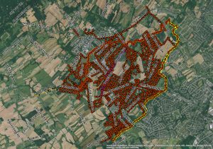
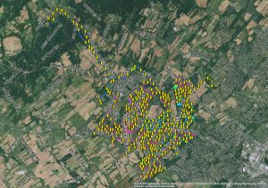
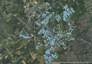
A Geographic Information System (GIS) is defined as a system of hardware and software used for storage, retrieval, mapping and analysis of geographic data. Dover Township has invested in both a GIS Specialist and the development of an extensive and accurate GIS consisting of numerous datasets including:
| Aerial Photography | Contour Lines | Flood Plains |
| Roads | Streams | Subdivisions |
| Parcels | Sewer Manholes | Sewer Lines |
| Stormwater Outfalls | Stormwater BMPs | Stormwater Lines |
| Stormwater Manholes | Water Pump Houses | Water Storage Tanks |
| Water Valves | Water Lines | Water Fire Hydrants |
| Water Hydrant Laterals | Water Pit Meters | Wells |
The list above does not contain all datasets that Dover Township collects and maintains. This data is essential for daily operations as well as long-term planning. It helps both administrative staff and field workers alike to perform their necessary tasks.
If you have further questions or would like more information regarding the GIS and Mapping program at Dover Township, please use the online contact form or the information below:
 Nathan Stone
Technology Specialist
2480 West Canal Rd
Dover, PA 17315
(717) 292-3634 Phone
Downloadable Township Maps
There will be two sizes available for downloadable/printable maps. ANSI D is one of the standard plan sizes with dimensions of 22 inches by 34 inches (you will need a plotter capable of printing this size or the detail will be too small). ANSI A is the standard letter paper size with dimensions of 8.5 inches by 11 inches. ANSI A is the paper size most suited for personal use.
Each map is in portrait orientation and does not contain aerial photography (this helps with document size and ink use on home printers). If you would like a map that has aerials, please see the contact information above.
All maps below are in Portable Document Format (PDF). If you do not have a PDF viewer installed on your computer, please download Adobe Reader or Foxit.
| Flood Map (ANSI A – 8.5″ x 11″) | Flood Map (ANSI D – 22″ x 34″) |
| Parcels Map (ANSI A – 8.5″ x 11″) | Parcels Map (ANSI D – 22″ x 34″) |
| Road Map (ANSI A – 8.5″ x 11″) | Road Map (ANSI D – 22″ x 34″) |
| Soil Drainage Map (ANSI A – 8.5″ x 11″) | Soil Drainage Map (ANSI D – 22″ x 34″) |
| Trash Collection Routes (ANSI C – 17″ x 22″) | Voting Districts Map (ANSI A – 8.5″ x 11″) |
| Zoning Map (ANSI A – 8.5″ x 11″) | Zoning Map (ANSI D – 22″ x 34″) |
Interactive Township Maps
Below you will find interactive maps based on Dover Township’s GIS data. These maps are hosted with ArcGIS Online by ESRI.
| Fire Hydrant Map | MS4 Area Map |
| Township Roads Map | WHPA Map |
| Zoning, Parcels & Flood Map |
Other GIS & Mapping Resources
If you are looking for more specialized data or mapping of an area other than Dover Township, please use the resources below:
| Census Bureau | Data Analysis and GIS Mapping |
| FEMA Flood Maps | PASDA |
| USGS National Map Viewer | USGS Maps |
| York County Parcel Viewer |


